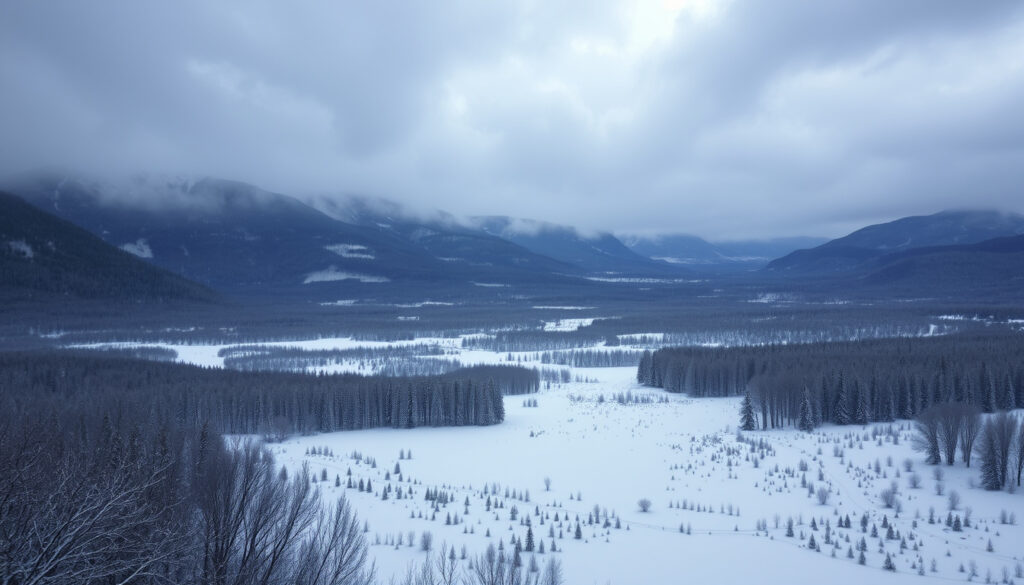
When Will It Snow – US Winter Forecasts and La Niña Impacts
Snow forecasts vary significantly by location, season, and atmospheric conditions. Understanding when snow is likely to fall requires examining pre-season predictions, historical patterns, and real-time meteorological data. This analysis provides a comprehensive overview of snow forecasting methods, recent snowfall trends, and what to expect during winter months in various regions.
Winter weather prediction has become increasingly sophisticated, combining satellite imagery, atmospheric modeling, and historical data analysis. However, the inherent complexity of weather systems means that long-range forecasts—especially those extending beyond two weeks—carry substantial uncertainty. Regional factors such as proximity to large bodies of water, elevation, and prevailing wind patterns all influence local snowfall amounts and timing.
The accuracy of snow predictions depends heavily on the forecast timeframe. Short-term outlooks benefit from high-resolution modeling and real-time observations, while seasonal projections rely on broader climate indicators like ocean temperatures and atmospheric oscillations.
When Will It Snow in Major Areas?
Snowfall patterns across North America demonstrate considerable regional variation. The timing of first snow and total seasonal accumulation depends on latitude, elevation, and proximity to moisture sources. Major metropolitan areas often receive extensive monitoring and forecasting attention, providing residents with detailed predictions.
Chicago and Rockford saw earliest significant snow since 1905 and 1978 respectively in 2025-2026
Weak La Niña (57-79% chance Dec-Feb) favors northern US above-average snowfall
Chicago: 17.1 inches by Dec 7; Rockford: 17.1 inches by Dec 7 (near full prior winter total)
Pacific Northwest: Increased snow; Southern US: Drier conditions; Upper Mississippi Valley: Wetter
- Pre-season forecasts for winter 2024-2025 predicted increased northern US snowfall due to weak La Niña conditions
- The 2025-2026 season began exceptionally early, with both Chicago and Rockford recording their earliest significant snowfall in decades
- Lake-effect snow events produced up to 12 inches in northern areas during November 2025
- Northern regions showed above-average precipitation probability, while southern areas experienced drier conditions
- December 2024 featured higher-than-expected snowfall across much of the United States
- Historical data reveals that post-1990s La Niña winters tend to be warmer and more variable than pre-1990s patterns
- Upper Mississippi Valley showed 33-40% chance of wetter-than-normal conditions during La Niña winters
| Location | 2024-2025 Total | Average Seasonal | 2025-2026 Early (Dec 7) | Notable Pattern |
|---|---|---|---|---|
| Chicago, IL | 17.6 inches | 37.1 inches | 17.1 inches | 4th snowiest start since 1978 |
| Rockford, IL | 17.1 inches | 38.4 inches | 17.1 inches | Snowiest start since 1905 |
| Pacific Northwest | Variable | Above average | Expected increase | Colder, wetter conditions |
| Upper Mississippi Valley | Below average | 38-40 inches | Above average early | 33-40% wetter probability |
| Southern US | Drier pattern | Minimal | Minimal | La Niña-driven dryness |
| High Elevation (N. America) | Rare early | Variable | August 2024 (rare) | August snowfall possible |
What Is the First Snow Forecast for Winter?
Pre-season winter forecasts provide valuable guidance for communities, businesses, and individuals preparing for cold weather. These outlooks combine atmospheric modeling with climate historical data to project likely conditions during peak winter months.
La Niña Influence on Winter 2024-2025
Forecasters identified a weak La Niña pattern with 57-79% probability for the December through February period. This climate indicator historically favors certain regional weather patterns across North America. The phenomenon develops when sea surface temperatures in the central and eastern Pacific Ocean drop below normal, altering jet stream behavior and storm tracks.
Under weak La Niña conditions, the northern United States typically experiences increased precipitation and potentially colder temperatures. The Pacific Northwest often sees enhanced snowfall due to more frequent moisture-laden storms approaching from the Pacific. Meanwhile, southern regions tend to experience drier overall conditions, reducing the likelihood of significant snowfall in states like Florida and southern Texas.
Pre-season forecasts typically incorporate multiple data sources including NOAA Climate Prediction Center outlooks, historical La Niña patterns, and medium-range global climate models. The December 2024 forecast emphasized potential cold outbreaks into the Midwest and East via cross-polar flow, with higher-than-expected snowfall across much of the United States.
Upper Mississippi Valley Outlook
The Upper Mississippi Valley region—including parts of Illinois, Iowa, Minnesota, and Wisconsin—received particular attention in winter forecasts. Historical analysis indicated a 33-40% chance of wetter-than-normal conditions during the 2024-2025 season, placing this region in the wettest third of winters since 1991.
Temperature predictions for the region proved more uncertain. Equal chances existed for temperatures being near, warmer, or colder than normal. This unpredictability stems from shifts in La Niña behavior observed since the 1990s. Data from the Upper Mississippi River Forecast Center reveals that five of the six warmest La Niña winters since 1990 occurred after the decade began, indicating a fundamental change in how the phenomenon affects regional temperatures.
How Accurate Are Snow Predictions and Why Do They Change?
Snow forecasting accuracy varies substantially depending on the prediction timeframe and geographical specificity. Short-term forecasts benefit from high-resolution modeling and direct observation, while seasonal outlooks provide probabilistic guidance rather than precise predictions.
Short-Term Forecast Reliability
Predictions extending seven to ten days demonstrate reasonable accuracy for timing and general accumulation amounts. Meteorological services regularly update these forecasts as new data becomes available, allowing residents to plan accordingly. However, small-scale features like lake-effect snow bands can produce dramatically different accumulations within relatively small distances.
Long-Range Outlook Limitations
Seasonal forecasts spanning months face inherent challenges. While broad climate patterns like La Niña provide useful context, they cannot account for individual storm systems that determine actual snowfall. The 2024-2025 pre-season forecasts correctly identified northern regions as likely to receive above-average precipitation, yet the extraordinary early-season intensity of the 2025-2026 winter surprised many observers.
Long-range outlooks from NOAA and other agencies refine continuously as new atmospheric data accumulates. Pre-season forecasts for winter 2024-2025 showed mixed signals regarding temperature, reflecting genuine uncertainty about how weak La Niña conditions would interact with existing weather patterns.
Factors Causing Prediction Changes
Several factors contribute to forecast revisions. Atmospheric conditions remain inherently chaotic, meaning small variations in starting conditions can produce substantially different outcomes. Ocean temperature patterns evolve throughout the season, altering the energy available to drive weather systems. Polar vortex strength and position influences how cold air masses move into populated regions.
Additionally, the post-1990s behavior of La Niña patterns has complicated seasonal predictions. Before 1990, La Niña winters in the Upper Mississippi Valley typically brought colder and drier conditions. Since then, the relationship has shifted, with more frequent warm and wet episodes during La Niña events.
Historical Snow Patterns and Averages
Understanding historical snowfall patterns provides essential context for interpreting current forecasts. Long-term records reveal significant variation in both timing and accumulation across regions, with climate shifts evident in multi-decade comparisons. For the latest US winter forecasts and La Niña impacts, check out Meteo Toscana notizie oggi.
First Snow Timing by Region
Average first snow dates vary dramatically across North America. Northern cities typically see initial snowfall in October or November, while southern metropolitan areas may wait until December or January for meaningful accumulation. High-elevation regions occasionally experience rare August snowfall, though this occurs infrequently.
Chicago’s records demonstrate the variability inherent in winter weather. The city experienced below-average snowfall during winter 2023-2024, followed by an exceptionally early and intense start to the 2025-2026 season. By early December 2025, the city had already recorded 17.1 inches of snow—the fourth snowiest start to a winter since systematic record-keeping began in 1978.
Accumulation Trends
Seasonal snowfall totals show considerable year-to-year variation. Chicago’s average seasonal accumulation stands at 37.1 inches, while Rockford averages 38.4 inches. Winter 2024-2025 fell well below these averages in both cities, with only 17.6 inches and 17.1 inches respectively. The dramatic turnaround in 2025-2026, when both cities approached their entire prior-season totals by early December, underscores the unpredictable nature of winter weather.
Snowfall patterns differ substantially across regions. While northern cities like Chicago and Rockford experienced exceptional early-season snowfall in 2025, southern states including Florida and southern Texas remained largely snow-free, consistent with established La Niña patterns.
2025-2026 Early Season Timeline
The winter of 2025-2026 delivered unprecedented early-season snowfall across the Upper Mississippi Valley. Several notable events shaped the trajectory of the season:
- August 2024: High-elevation areas in North America saw rare early snowfall, marking an unusual start to the snow year in mountainous regions.
- November 9-10, 2025: Lake-effect snow events produced up to 12 inches in areas north of I-80, marking the beginning of an exceptional early-season pattern.
- November 29-30, 2025: A post-Thanksgiving storm system delivered up to 12 additional inches across the region, accelerating accumulation well ahead of seasonal averages.
- December 1, 2025: A broad system deposited 1-3 inches, with highest amounts south of I-80, continuing the early-season activity.
- December 6-7, 2025: A clipper system brought 3-7 inches to areas north of I-80, with Chicago and Rockford each accumulating approximately 17 inches total since November.
- December 7, 2025: Both cities reached accumulation levels nearly matching their entire 2024-2025 seasonal totals, establishing record-setting pace for the winter.
What We Know and What Remains Uncertain
| Established Information | Remaining Uncertainties |
|---|---|
| Winter 2024-2025 produced below-average snowfall in Chicago (17.6 inches) and Rockford (17.1 inches) | Whether the early 2025-2026 intensity will sustain throughout the season |
| Weak La Niña conditions (57-79% probability) influenced winter 2024-2025 patterns | Precise impacts of La Niña on specific regional temperature outcomes |
| Chicago experienced its 4th snowiest start since 1978 by December 7, 2025 | How climate change is affecting long-term snowfall averages and timing |
| Rockford recorded its snowiest start since records began in 1905 | Storm-by-storm accumulation amounts beyond 10-day forecasts |
| Northern US received above-average precipitation during weak La Niña winters | Spring 2025 snow continuation probability along Canada/US border |
| Southern US remained drier, consistent with La Niña patterns | Specific impacts on individual metropolitan areas beyond broad regions |
Understanding Winter Weather Patterns
Winter snowfall results from complex interactions between atmospheric conditions, geographical features, and large-scale climate phenomena. The dramatic swing from below-average conditions in 2024-2025 to exceptional early-season accumulation in 2025-2026 illustrates how quickly patterns can shift.
La Niña conditions represent one of several factors influencing North American winter weather. The phenomenon’s effects vary depending on intensity, duration, and interaction with other atmospheric patterns. Since the 1990s, researchers have observed changes in how La Niña manifests regionally, with warmer and more variable conditions becoming more common during these events.
For residents in snow-prone regions, understanding local historical patterns provides valuable context for interpreting forecasts. While no prediction can guarantee specific outcomes, combining pre-season outlooks with short-term forecasts and historical data helps communities prepare for winter conditions effectively.
Sources and Expert Perspectives
Winter weather forecasting relies on data from multiple governmental and commercial sources. NOAA’s Climate Prediction Center provides seasonal outlooks based on extensive modeling and historical analysis. Local National Weather Service offices issue detailed forecasts and historical documentation for their service areas.
“Pre-season forecasts emphasized increased northern US snowfall due to weak La Niña, with wetter conditions predicted for parts of the Upper Mississippi Valley.”
— NOAA Climate Prediction Center, Winter 2024-2025 Outlook
“The 2025-2026 season began exceptionally early and snowy, with both cities accumulating nearly their full prior winter totals by December 7, 2025.”
— National Weather Service Chicago/Rockford Office
Additional forecasting organizations including Snow Forecast and Severe Weather EU contribute regional analyses and long-range projections. These sources provide supplementary context for understanding broad weather patterns, though specific city-level data remains most reliable from official meteorological services.
Summary
Snow forecasting combines sophisticated modeling with historical patterns to provide guidance for winter weather preparation. Pre-season outlooks for winter 2024-2025 correctly identified northern regions as likely to experience above-average precipitation, though the extraordinary early-season intensity of 2025-2026 exceeded expectations. Chicago and Rockford recorded their earliest significant snowfall in decades, with both cities accumulating approximately 17 inches by early December 2025—nearly matching their entire prior-season totals. For those seeking more detailed information about Arctic outbreak patterns or current seasonal conditions, additional resources are available from meteorological sources.
Frequently Asked Questions
When can I expect the first snowfall in my area?
First snowfall dates vary significantly by latitude and elevation. Northern cities typically see snow by October or November, while southern areas may not receive accumulation until December or January. Check local National Weather Service offices for historical averages specific to your location.
How accurate are long-range winter snow forecasts?
Seasonal forecasts provide probabilistic guidance rather than precise predictions. Pre-season outlooks correctly identified northern regions for above-average precipitation in 2024-2025, but could not predict specific storm events or the exceptional early-season intensity of 2025-2026.
What causes La Niña to affect winter snowfall patterns?
La Niña develops when Pacific Ocean surface temperatures drop below normal, altering jet stream behavior and storm tracks. This typically brings increased moisture and colder air to northern regions while creating drier conditions in southern areas.
Why was the 2025-2026 winter so snowy in the Midwest?
The season featured multiple early-season storm systems including lake-effect events and clipper systems. By December 7, 2025, Chicago and Rockford had recorded their earliest significant snowfall in decades, driven by persistent northerly flow and active storm tracks.
Does it snow in southern states like Florida or Texas?
Significant snowfall is rare in southern states during most winters. Under La Niña conditions, these regions typically experience drier overall weather patterns, reducing snow probability. Southern Texas and Florida rarely receive measurable accumulation.
What is the average seasonal snowfall for major cities?
Chicago averages 37.1 inches annually, while Rockford averages 38.4 inches. These figures represent long-term means—individual seasons vary dramatically, with 2024-2025 producing well below average and 2025-2026 exceeding all expectations.
How do meteorologists predict lake-effect snow?
Lake-effect snow occurs when cold air passes over relatively warm Great Lakes waters, picking up moisture that subsequently falls as snow over land. Forecasters monitor air temperature, water temperature, and wind direction to predict these localized heavy snowfall events.
More related posts
 Chris Eubank Jr: Record, Net Worth, Family & Next Fight
 How to Stop Overthinking – Effective Strategies That Work
 How to Improve VO2 Max – Proven Training Methods
 Euro Pound Exchange Rate 2026: Forecast & Conversion Guide
 Philadelphia Eagles vs 49ers Match Player Stats: 2026 Game
 Best Salmorejo Near Me: Authentic Spanish Cold Tomato Soup
 Anthony Joshua: Nigeria Crash, Suspension, and Jake Paul Win
 Sir Harold Hillier Gardens: History, Visits & Info